
Nearby tours in Øvre Årdal
Visit Årdal gives you the 5 best hikes to go on in Øvre Årdal with the center as a starting point. You haven't seen Årdal before you've seen it from above! Fjords and mountains as far as the eye can see are balm for the soul and make it well worth walking up the steep mountain sides towards the goal.
1) The Blåberg mines

PHOTO: Torunn Todal Laberg
Start at the Square in Øvre Årdal Follow Storevegen and Flotavegen towards Øvstetun and the start of Tindevegen - the road up Fardalen towards Turtagrø . At the fourth bend you cross Fardøla by walking over the Kleivi bridge, and from here you continue on a clear path that leads you up to a mining area that was in full operation 300 years ago. The old copper mines are an exciting destination in themselves for both young and old, and you get a beautiful view of the entire Øvre Årdal , Årdalsvatnet and towards Bøttejuv. You can also glimpse Årdalstangen in the distance. The hike is steep at times. Time: about 1.5-2 hours
2) Heirsnosi “ Tusenmeteren "
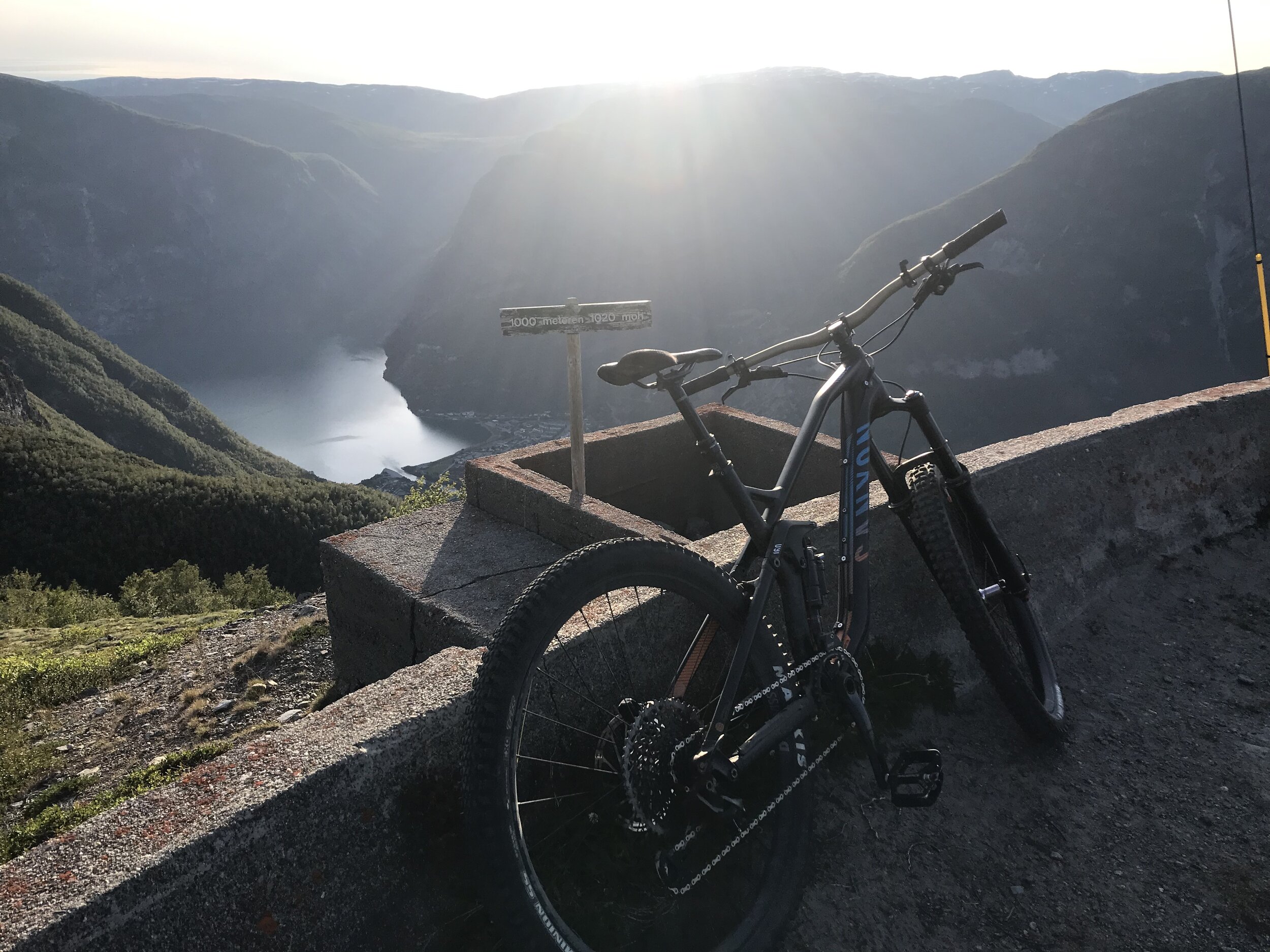
PHOTO: Lars-Kristian Fauske
Start at the Square in Øvre Årdal . Go up Tyinvegen (FV 53) until you reach the 400-meter mark, where the old road up the mountainside winds in narrow bends. Then follow the gravel road all the way to the top, and you will get a fantastic view of both Øvre Årdal , Årdalsvatnet and Hurrungane in the distance. An alternative is to take your bike from Sletterust, and cycle the old construction road all the way to " tusenmeteren " and then down the turns to Upper Årdal Time: about 2-4 hours.
In the fall of 2020, construction work will take place on the old road, which may result in the road being closed to all traffic for periods.
3) Ramneberg and Botnanosi

PHOTO: Rigmor Øygarden
The starting point is the square in Øvre Årdal . Tough start up Mjøbakken, but about 100 meters after the row of houses you turn left (80 meters above sea level) from the asphalt road and enter a nice path that is well marked. At about 160 meters above sea level you pass the stand at the shooting range of Farnes shooting club. Here the path goes somewhat flatter through a forest of small birch before it rises more and comes over into rocks and mountains. The last bend may seem a bit steep from below, but when you get closer it loosens up and it is still easy to make your way. Feel free to take a walk out to the viewpoint "Bringestein", before continuing upwards towards Botnanosi. The locals call the viewpoint Ramneberg. You can easily end the walk here and get the full reward with regard to the view, but if you want to feel that you really get some air under your wings, you should continue towards the cairn at Botnanosi. In some places it is exposed and steep, so take it easy and stay on the path as you continue upwards. The view from Botnanosi at 1387 m is top ten, and many year-rounders' absolute favorite. Time: 2-3 hours up.
4) Åsen and Åsenosi

PHOTO: Rigmor Øygarden
The starting point is the square in Øvre Årdal . From here you can drive your car to the parking lot below Moa (follow FV 53 towards Tyin and turn off towards Moa a short distance after you have passed Hydro Aluminium). Follow the road towards Moa and keep left after the small bridge. There you will find parking for your car. Alternatively, you can walk from the square in Øvre Årdal towards Hydro Aluminium, and follow the footpath at the back of the factory to the parking lot under Moa. This is also the starting point for the hike to the day trip cabin at Moakamben and to the plateau at Ytre Moa where they can study both burial mounds and house ruins from the Viking Age . The path to Åsen and Åsenosi starts behind the garage on the far right by the houses at Moa. Follow the path up the valley until you reach the fork in the path with the sign “Åsen”. Turn left uphill towards Fugleåsen/Svalheimsåsen. Then keep right when you get to the ridge, and follow the path all the way to the farm on Svalheimsåsen. The hill is a nice place when you get up. To the north, the Hurrungane emerge with Stølsmaradalstindane, Midtmaradalstindane, Storen, Styggedalstindane and Gjervvasstinden, and the view back down towards Årdalsvatnet and with Bøttejuv in the middle is great. Here you can choose to end the trip and return down the same road, or you can continue uphill towards Åsenosi (1222 m above sea level) on the marked trail from Åsen. Time: 2-4 hours up.
5) The day trip hut at Moakamben

PHOTO: Torunn Todal Laberg
The day trip cabin in Årdal is located on Moakamben, above Ytre Moa. The cabin is located at approx. 245 m above sea level. You can start the trip from Moa or from Lykkja in Utladalen . The day trip hut is a low-threshold offer for hikers - a place to eat your packed lunch, get some warmth and browse through books. Each hut has a Nynorsk hiking library with many different books.
By car : You can park in the parking lot at Moa. Follow the signs to Moakamben from the parking lot at Moa. After about 200 m, the path turns off to the left. The path is steep at the start, but gradually flattens out. It takes about 40 minutes from the parking lot to the cabin.
On foot or by bike: Follow the path from Lykkja in Utladalen . There is no parking here. Keep right at the trailhead on Moa-åsen. There are several alternative routes/trails to the trailhead at Årdal Hiker. Make sure you don't take the path to the right down towards Utladalen that! The trip to Moakamben normally takes 0.5-1 hour.